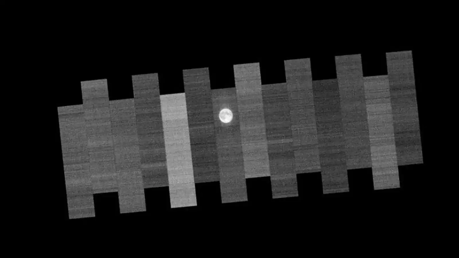
Since 1972, NASA’s Landsat program has relied on an unlikely calibration source: the Moon. Fifteen times over the course of two orbits, Landsat maneuvers to image the lunar surface, a process far more frequent and detailed than a single check. Once a month, at the full Moon, the spacecraft turns its instruments away from Earth and points them at the lunar surface, and this consistent practice ensures the accuracy of the program’s decades-long record, tracking changes in everything from crops to glaciers. With no atmosphere and virtually no surface changes, NASA’s Earth Observatory notes, the Moon reflects sunlight in a predictable, consistent way, giving engineers a fixed reference against which to fine-tune the instruments. Scans from band 4 of the Operational Land Imager on Landsat 9, captured on January 3, 2026 and comprised of data from 14 detector modules, demonstrate the granular level of assessment used to maintain data consistency.
Landsat 9 Uses Lunar Surfaces for Calibration
Landsat 9’s calibration relies on a surprisingly stable and consistent source: the Moon. For over half a century, NASA’s Landsat program has employed lunar surfaces as a crucial element in maintaining the accuracy of its long-term Earth observation record, a practice that continues with the current Landsat 9 mission. Unlike terrestrial calibration sites susceptible to seasonal and weather-related changes, the Moon offers a remarkably static reference point for fine-tuning instrument sensitivity. This technique ensures that data collected remains directly comparable to imagery acquired decades ago, vital for tracking subtle environmental shifts. Each module is systematically assessed, and one is even scanned twice, to identify and correct for any unintended sensor drift. Ross Walter and Madeleine Gregory of Landsat Project Science Support, who wrote up the January 2026 lunar scans for NASA’s Earth Observatory, describe calibration as running from before launch all the way to the end of a satellite’s life.
While the Moon serves as a primary calibration tool, it is not the only one. Landsat also utilizes uniform terrestrial features like the White Sands desert in New Mexico and ground-based measurements to validate its readings. These combined efforts distinguish Landsat imagery from typical photographs, delivering crucial, scientifically-validated data for monitoring habitats, agriculture, and broader environmental trends.
OLI Detector Modules and Moon Imaging Process
The consistency of data stretching back over half a century is a hallmark of the Landsat program, and the Moon plays a key role in maintaining that record. Since 1972, engineers have leveraged the Moon’s stable surface as a calibration reference for Landsat instruments, ensuring comparability of images collected across decades. The scans were collected via fourteen detector modules within the instrument’s focal plane, with one module imaging the Moon twice, demonstrating the complexity inherent in ensuring data accuracy. This combined approach ensures that Landsat imagery provides crucial, scientifically sound data for tracking changes in everything from agricultural patterns to glacial extent, solidifying its position as a vital resource for Earth observation.
Consistent Data Validation: Moon, Deserts, and Ground Measurements
The Landsat Project Science Support team, whose Ross Walter produced the lunar scan animations, maintains the integrity of over half a century of Earth observation data through a multi-faceted calibration process, extending beyond terrestrial checks to include both lunar surfaces and desert landscapes. The Landsat program, operational since 1972, relies on the Moon’s stable reflectance as a primary calibration source; unlike Earth, the lunar surface experiences minimal atmospheric interference or geological change, providing a consistent benchmark for instrument accuracy. This granular level of assessment ensures data consistency across the entire sensor array. Ground-based measurements further corroborate satellite readings, specifically verifying surface temperature data against Landsat’s thermal band; this comprehensive approach distinguishes Landsat imagery from typical consumer photographs, delivering crucial information for tracking environmental changes, habitat mapping, and agricultural monitoring. The combined strategy ensures a continuous, comparable record spanning decades, enabling scientists to confidently analyze long-term trends in Earth’s land surface.